Embedded Files
Fairbanks to Wasilla
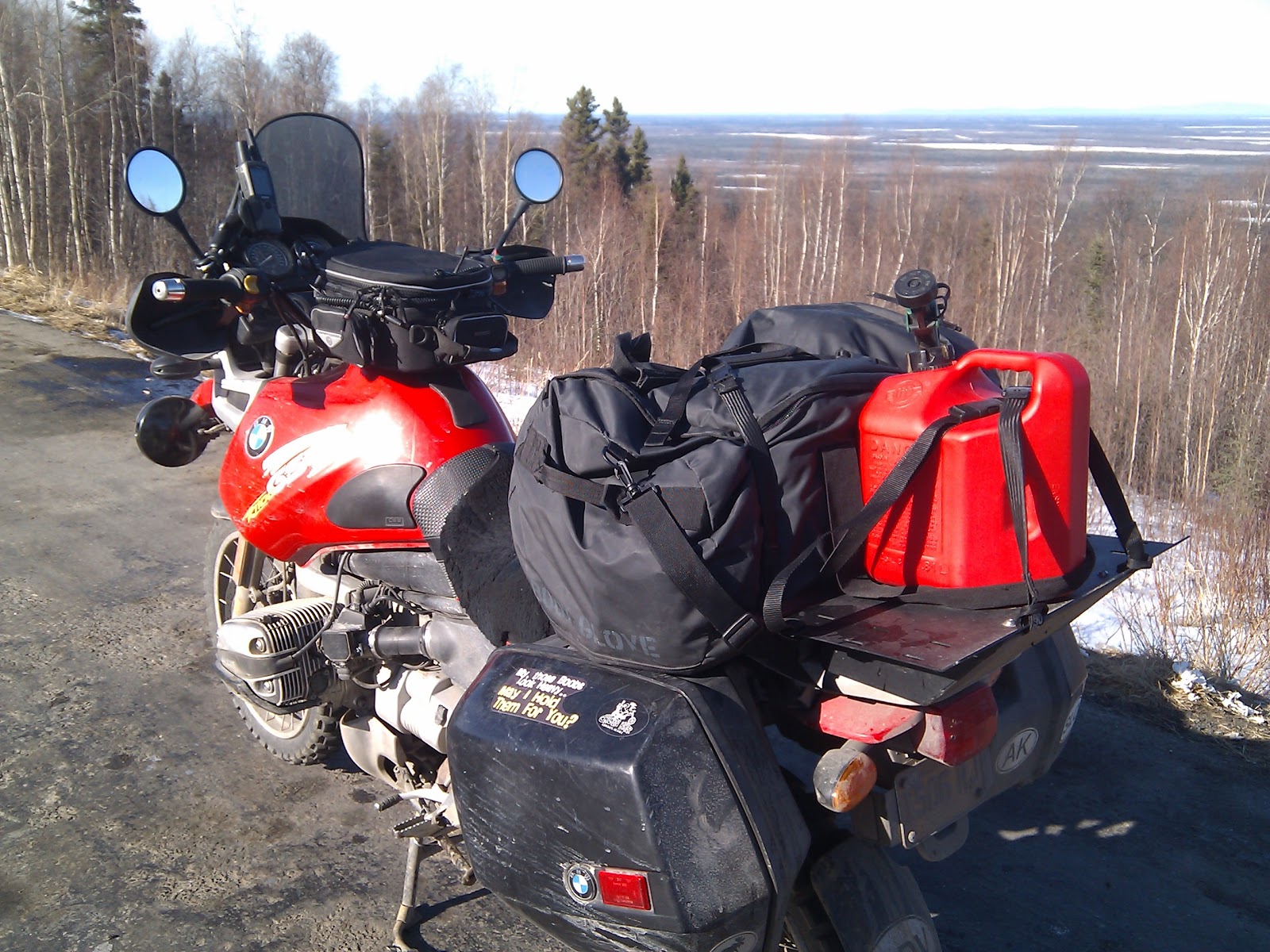
Once again, the Gods blessed the morning with warm rays of life affirming sunshine. Suiting up in my dayglow cocoon I was already breaking a sweat. I suppose it would seem strange to some that a person could sweat in 40 degree weather, but after a long cold winter, and a slow spring 40 feels like 80.
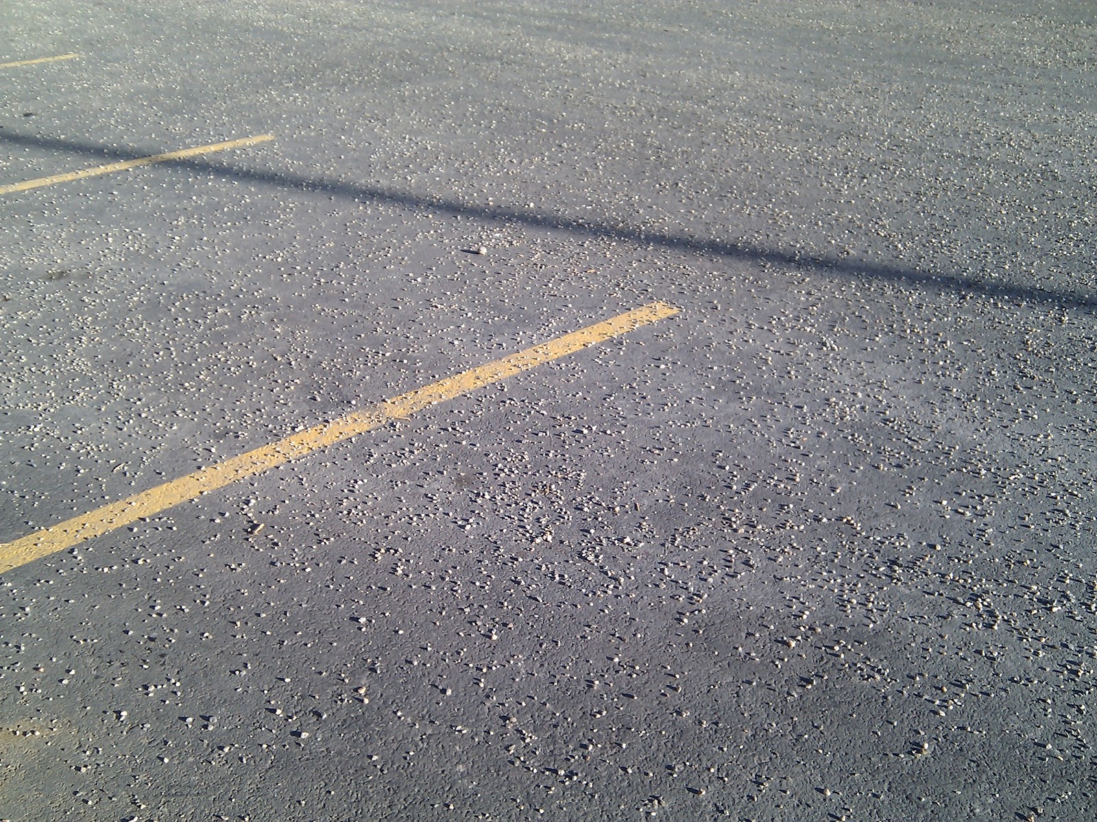
The thing I loved most about Fairbanks (besides all the beautiful women) was that somebody had spread marbles all over every Hard surface. For an adventure rider, this presents a fabulous opportunity to practice their gravel skills.
The ride south out of Fairbanks is as spectacular as the ride in. Long sweeping curves, up and down 1000+ foot elevation changes, and views that one will never see anywhere else on earth. I guess it is not early enough in the season for the frost heaves to be to bad yet, so the road is smoooooth and in perfect condition. None of the marbles from town.
Riding down the parks Highway the road climes out of the Golden valley in which Fairbanks resides. then up , alng, and over a ridge-line before dropping into the Nenana valley. Actually I think it is more accurately considered part of the Minto flats. As you can see, that particular valley stretches for just about ever.
72 or so miles south of Fairbanks the road crosses the Tanana river where the Nenana river flows into it.
The bridge is fabulous but was to windy to stop on. So I didn't I did however evaluate the ice conditions, and next stop put in my guess for the ice classic. April 7th at 11:59 PM? Winning that would put several new 1200GSA's in my garage...
I stopped in Nenana to check the air pressure in my tires. As I had mentioned before, i noticed a strange wear pattern on my front TKC. Sure enough, the cold had stolen about 10 PSI from both tires. Probably too late to save them now, but I felt a little more comfortable riding on properly aired tires the rest of the way.
After Nenana the road climbs again, crosses about 15 miles of high tundra then winds onto the east side of a ridge overlooking a long straight valley. In this valley we find the sleepy little Town of Healy. And along this valley it I found the wind. This is one of those sections of road that I bet can be awful chilly if you hit it after the sun is behind the ridge to the west. Fortunately, I hit it while the sun was still bathing it.
Somewhere out of Healy is that place where that kid wandered off into the wilderness a couple years back. The movie however was filmed way south in Cantwell.
Just for the record, Lots of people in Alaska wander of into the wilderness to live off the fat o the land. Quite a few are very successful at it, but it takes a mettle that you probably don't find much in people any more.
After Healy, the road climbs again. and prepares to wind through the Nenana canyon through the pass at Denali Village. If my memory serves me, the road enters the canyon at about 1800 feet above sea level. At these latitudes that is significant and brings with it colder temps, and higher winds.
Dropping down into the Canyon the road crosses the Nenana for the first of many times, over a curved high bridge. This is were the only "oh Shit!" moment of the whole ride occurred. I had just passed a land cruiser that was having a little difficulty staying on the road in the wind. There was a sign on the right that proclaimed "Wind Area" I could see the bridge coming, and I knew what it meant to come out from behind a rock formation onto a bridge crossing a deep canyon in the wind.
After pointing to the sign for the benefit of the poor cager behind me, I had to make a quick evaluation of what to do. Not sure if it was right or not, but I choose to speed up a little and prepare for a maximum performance curve over the bridge leaning into the wind. I initiated the turn with just enough counter steer to lean the bike over into what would have been a beautiful sweeping apex. Just then, a gust came of the valley and tried to take out my lean, the gust was constant, and increasing in intensity, as I quartered around into it. Road racers talk about counter steering into a curve than holding the lean with opposite steering input. The wind was so intense at this point that I was putting in counter steer throughout the entire turn. fortunately the gust was constant, and didn't drop off while I was in the turn.
It wasn't exactly beautiful but it did keep me in my lane and got me through the curve alive without throwing me into the canyon below. It did however keep me awake for a little while last night, and I plan to start a discussion with other adventure riders to determine what the right thing is to do when confronted with a like situation. In the interest of justification, I will say, that slowing down in that wind, and taking the turn slowly with less momentum, an less bike control did not feel right. That is why I sped up.
Denali Village is an interesting place. It is the place where the cruise companies take all the tourists to show them the "real" Alaska. It is far from the real Alaska, and it is all closed down from September to May. Yes, an entire town completely closed and abandoned. It was a bit more than eerie. The real Alaska is that places like this are uninhabitable during the winter months.
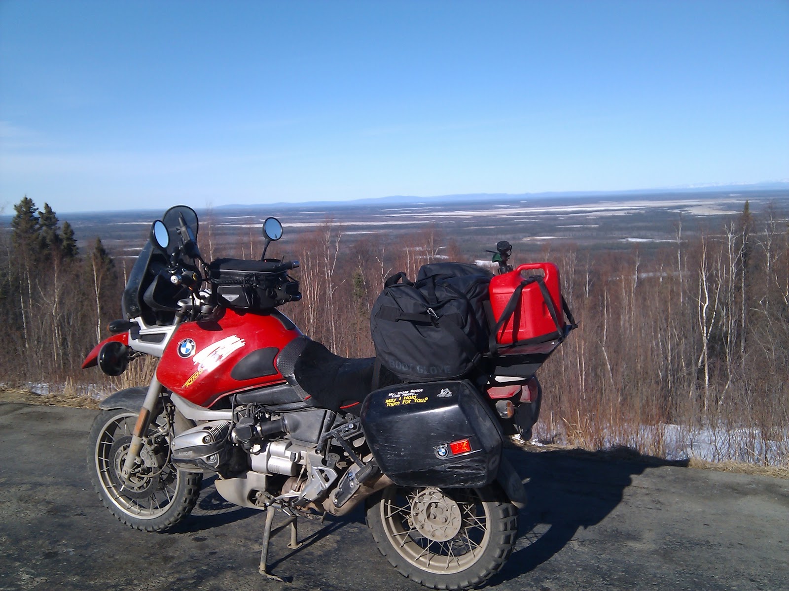
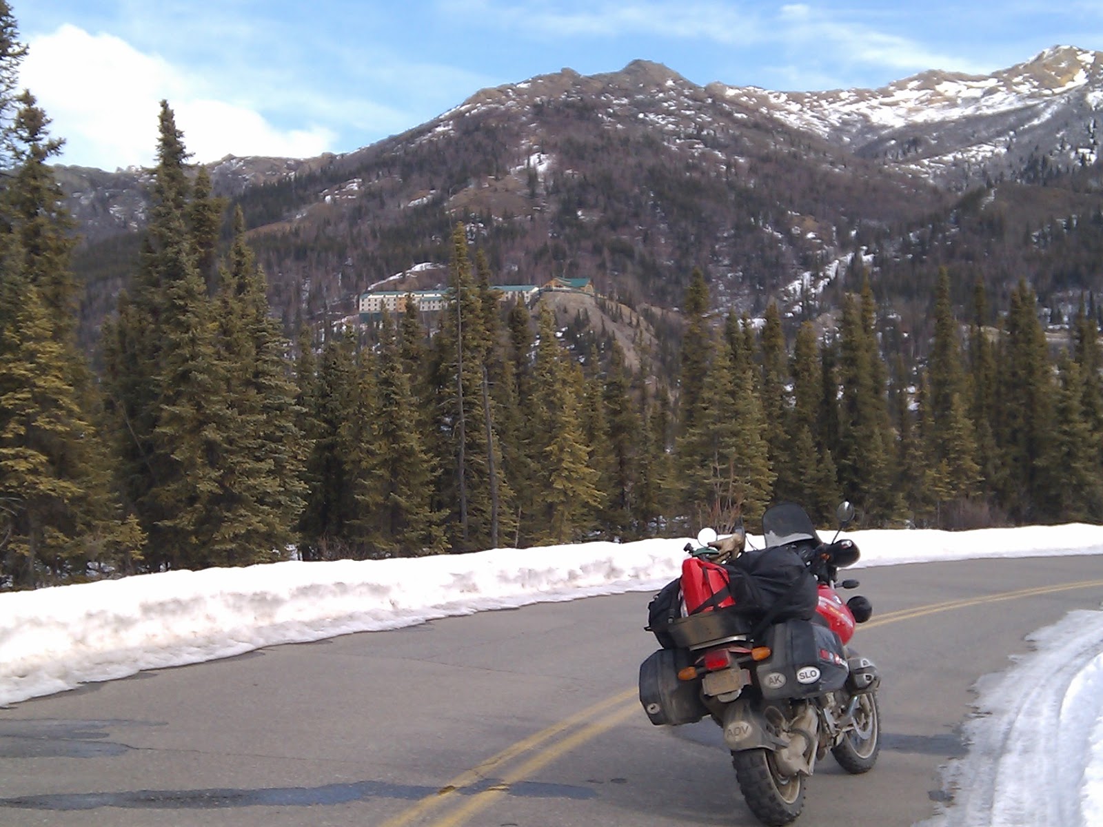
I took a right and rode up the park road a spell to do what every good Alaskan boy should do on federally occupied land. Again, no pictures of that but here are some pictures from the park road.
In this picture, off in the distance, you can see one of the hotels on the hillside in Denali village.
Back on the road. Next stop 27 miles toCantwell for fuel. After the canyon, the road calms down a little bit. It crosses a couple more little river canyons, then starts a long slow, curving decent. The road parallels much of the Nenana river, and crosses it and its various forks many more times, before a jaunt across tundra into Cantwell.
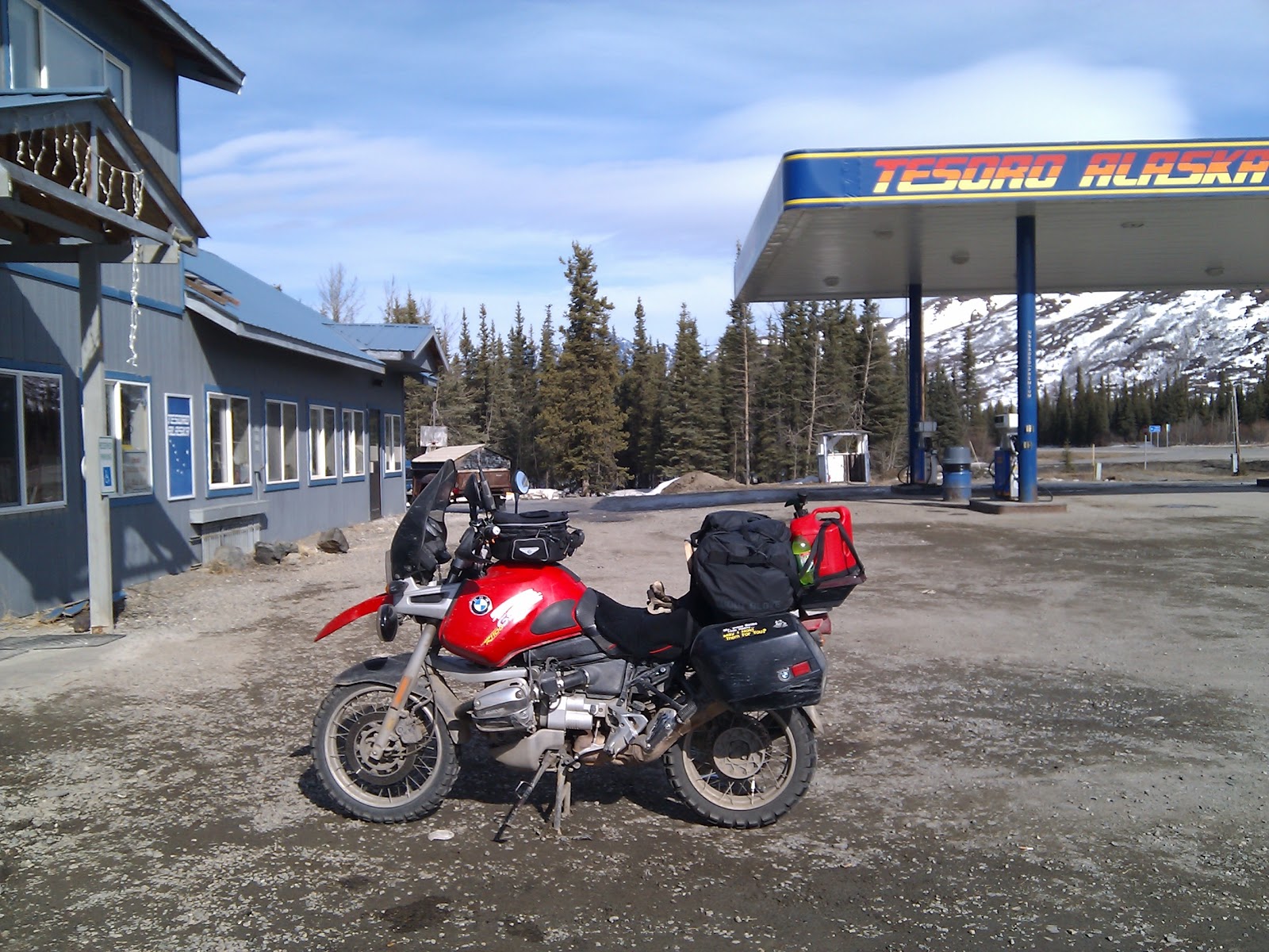
Cantwell is famous to Alaskans for many things. Not the least of which is being about the only gas between Sunshine and Fairbanks for much of the year. It is also where the Denali Highway takes off to the east. I have ridden the Denali highway, and will again as soon as it is passable. Highway, is a bit of a misleading term as it is actually 140 miles of gravel and potholes, and broken motorhomes. (Ah, the real Alaska)Among some circles, Cantwell is famous for a seemingly mythical BBQ joint. I have yet to find it open, but I did actually see the sign this time. Or maybe it was a mirage?
I have spent a few moons in Cantwell, in both seasons and find it to be a real Alaskan experience. The people are friendly in a "fuck you I live here" sort of way. and the adventures are endless. Maybe next time I will get to report about the BBQ.
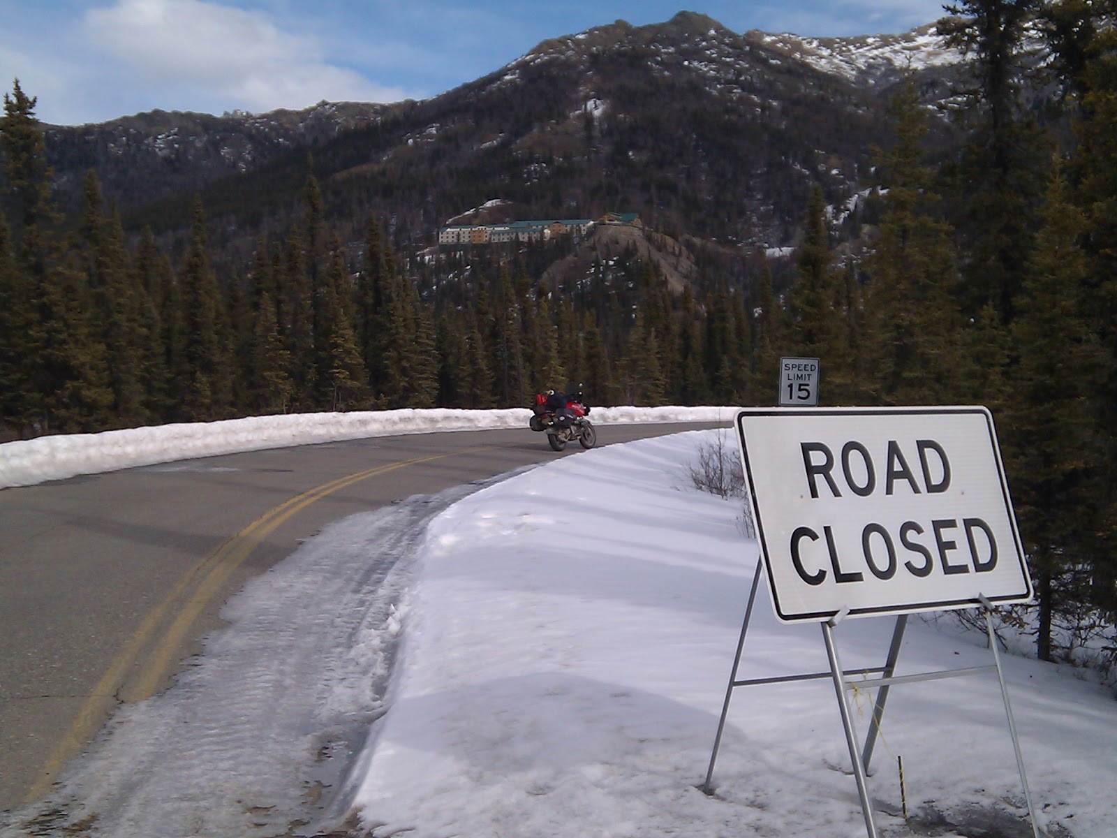
After cantwell, the road climbs again to a place known as Summit. IT is marked only by a small sign teling the traveler of summit airstrip. at 4300 feet above sea level this is the highest point on the parks highway.
after winding down and around a little from summit one will come upon the only igloo I have ever seen in Alaska. It is known to Alaskans as simply "Igloo" . I think it was at one time a hotel. Now it is just anoter abandon landmark.
This area gets a lot of snow, and has many turn outs and trail heads populated by snowmachiners in the winter. This place on the road alwys makes me feel small. The valley is huge, and the peaks loom all arround in the full opulent glory of creation. One can not help but be in awe.
The road gets twisty again descending from summit into the Beyers creek valley. Great riding, on pretty good road. However, some of the turns are shaded and could be wet and or icy, especially around coal creek. If you are at all observant of the surrounding geology you will know when you are close to coal creek.
There is a war memorial at Beyers creek. Then the road climbs up and around some more twisties. Here is where some of the best Denali views from the highway exist. Watch for the signs, and pull over, if you are there on one of the 60 days a year that Denali is visible, you will be rewarded with one of the best view on the continent.
after a bit more twisting, and crossing the Chulitna river the road enters a stretch of high tundra punctuated by lakes, creeks, black spruce, and a feeling of desolation. Eventually Trappers creek comes into view. Here is where I stopped for Breakfast on the way up. Great food, in a cool little small town atmosphere with reasonable prices. I imagine those prices change a bit in the "on" season.
Here is where Petersville road takes off to the east. Petersville road is an awesome ride in itself. Given enough time, and the right time of the year, and a lot of courage, one could make a two day ride of Petersville road itself. Alas, that will have to wait until a little further into breakup to make my itinerary.
On to Sunshine. This is the part of the trip known as the treacherous last 100 miles. More accidentgs occur within the last 100 miles of a trip than anywhere else. I notice my average speed creeping upwards, and I also noticed my mind wondering to place other than were I was. This is never good on a motorcycle so I concentrated on being mindful of where I was, and what I was doing.
South of the Talkeetna cutoff the road is pretty straight. In the summer it is littered with tourists chasing salmon in the many creeks and rivers that are crossed by the highway.
I was suprized to see a nice new sign proclaiming that I was entering the willow area, while I sure I was still in the Montana Creek Area.
Then the road construction begins. It looks as if they are prepareing for a huge project of resurfacing and widening the highway. Being that this is probably the busiest traffi place on the Parks it will be a mess come summer. Better plan to loose an hour or so on this stretch of road.
Willow is reliable for Gas. Albeit expensive. Then there is Houston. What can I say about Houston? if you are not in Alaska following the local politics be aware that Houston's Mayor, wishes he was instead a Cop. When the city of houston can afford Cops, they earn there keep stopping people in the speed zone around town. When they can't the Mayor has been known to pull people over, and write tickets in his white BMW x5. I am not sure if he has ever actually ade a ticket stick, or if he has ever collected any revenue from one, but I do know he is unpredictable, and quite self righteous. It is advised to keep the speed down and your nose clean, and get through Houston quickly, lest you find out about Roger...
Houston leads to Meadow lakes, Across Vine, and back down KGB to home.
1008 miles total. Average temperature of 32 degree (if you count the 20's up on the haul road) Highest temperature observed 46 in Sunshine on the way home.
Next ride? Not sure yet, probably Petersville road, and the Denali. around the middle to end of May.
The thing about adventure riding in Alaska, is that every couple of miles presents more options for an adventure. Trails such as the Talkeetna spur trial (not the road). Petersville, and the stampede trail abound. I could spend the better part of the viable riding season in Alaska exploring these places. Maybe, I will......
Stay tuned, and God bless....
Page updated
Report abuse